ADAPT Researchers Enlist New Drone Technology to Help Put Trinity College on the 3D Map

Posted: 06/09/17
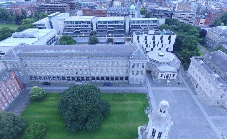
Expert researchers in the ADAPT Centre for Digital Content Technology have facilitated development of next-generation drone footage of Trinity College Dublin, which is helping to put Ireland’s leading university on the 3D map. This arises from a collaborative project with Intel which produced stunning video and imagery of the campus as seen from a bird’s eye view. The new data has a multitude of applications, including a 3D modelling project of the college.
As a famous landmark at the focal point of Dublin’s city centre, Trinity is visited and viewed by huge volumes of people each day. Between the numerous tourists, staff members, and students who tread through its campus on a regular basis, the internationally renowned university had – until now — been looked at from almost every angle.
Professors Rozenn Dahyot and Mary Bourke, from Trinity’s Schools of Computer Science and Statistics, and Natural Sciences respectively, are the academic sponsors of the initiative, which captured hundreds of high-res images and video footage earlier this month. Professor Dahyot is a funded investigator with the ADAPT Centre, a world-leading research centre funded by Science Foundation Ireland and led out of Trinity College. Her research team are interested in the fields of image and video processing, data analysis and machine learning, and will benefit directly from access to this extensive dataset of images. Professor Dahyot is involved in a number of research projects, including European projects H2020 BONSEYES and FP7 GRAISearch.
Professor Bourke and her research group use remote sensing and drone technology for landscape mapping and natural hazard management on Earth and Mars. In particular, they use it in natural and built stone environments, such as coastal cliffs and urban buildings in Ireland.
Working with a team of engineers and using a drone equipped with the Myriad 2 vision processing unit (VPU) from Movidius, an Intel company, high-resolution drone imagery was captured to construct a 3D model of the campus. Using a volumetric accelerator (VOLA) format, the imaging was compressed to achieve a 1000x smaller memory footprint, enabling drones to access detailed spatial map data without consuming the gigabytes of data typically required of 3D mapping.
Professor Dahyot said: “This experiment is an illustration of how today’s computer vision and drone technologies allow to efficiently capture and reconstruct our environment in 3D. Easy access to up to date 3D virtual environments mimicking our real world is not only essential for urban planning but also for training future artificial intelligence to understand and navigate safely in our world before being embedded into autonomous vehicles.”
Professor Bourke added: “This high-resolution image data of college buildings and grounds will allow us to view and assess the structures from perspectives that are difficult if not impossible to access. This will permit an assessment of issues such as natural stone decay in urban environments.”
The newly compiled dataset is open to all members of Trinity (access to the 800+ overhead images can be granted on request). Video footage can be viewed here.
The ADAPT Centre is delighted to have facilitated in generating new perspectives of Trinity College using state-of-the-art technology.
Share this article:


